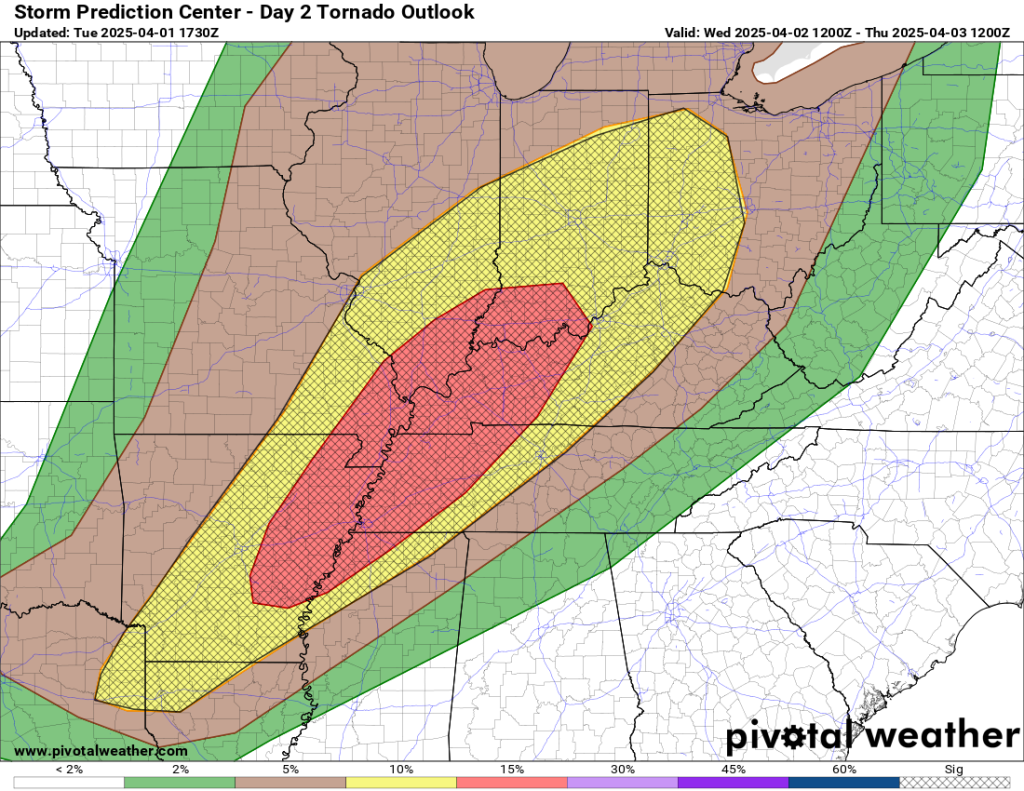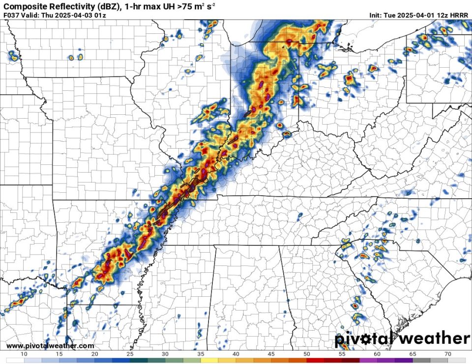
Residents across Northern Arkansas and Southeast Missouri should brace for a potentially dangerous weekend as a powerful storm system sets the stage for severe weather and historic flooding. Meteorologists are increasingly concerned about the evolving forecast, with high-resolution data pointing to a significant severe weather outbreak tomorrow, followed by excessive rainfall throughout the weekend.
Severe Storms Likely Tomorrow Evening
Weather models now clearly depict a strong line of storms forming by tomorrow evening, with an alarming amount of rotation detected within the system. The Energy Helicity Index (EHI), a key parameter used to measure the potential for tornado development, is registering between 4 and 6—well within the range for long-track, violent tornadoes. While nothing is ever guaranteed in weather forecasting, all the necessary ingredients for a major outbreak are present, including the risk of strong tornadoes, damaging straight-line winds, and large hail.
Residents are urged to stay alert and have a severe weather plan in place as conditions could deteriorate rapidly. The Storm Prediction Center (SPC) is expected to release an update at 12:30 PM CDT, providing further insights into the evolving threat.
Historic Rainfall and Flooding Expected
Beyond the severe weather threat, the system will also bring an unprecedented amount of rainfall. A slow-moving front is expected to stall over the region, leading to continuous waves of heavy rain. Some forecast models are projecting as much as 15 inches of rainfall in certain areas, a figure meteorologists say they have never seen on such a widespread scale in over a decade of forecasting for this region.
This prolonged heavy rainfall will lead to significant flash flooding and river flooding, affecting communities from Arkansas into Western Kentucky. Authorities are urging residents in flood-prone areas to prepare for rising water levels and to be ready for potential evacuation orders.
With a week of storms ahead and an increasing risk of severe weather and flooding, residents should stay tuned for updates from local officials and meteorologists. Another forecast update will be issued later today as more data becomes available.