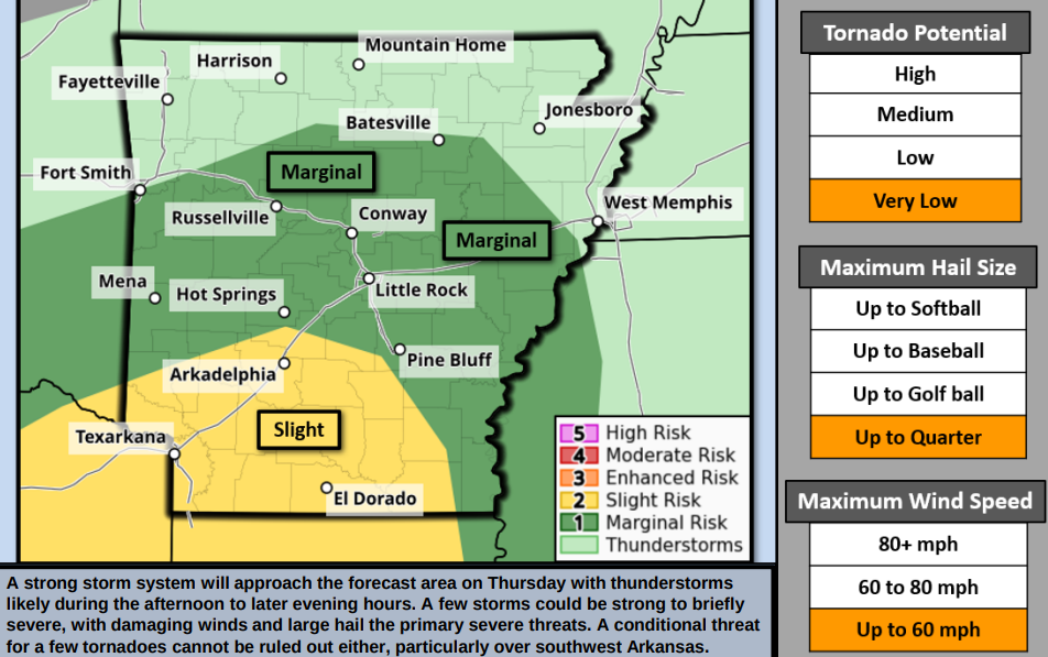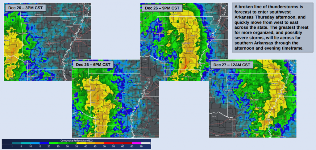
Arkansas is bracing for a powerful weather system expected to bring widespread rainfall and thunderstorms on Thursday. Simulated radar imagery for Thursday evening, around 7 PM, shows a large-scale system advancing across the state, with some storms potentially becoming strong, particularly in southern and southwestern Arkansas.
The system’s strength is noteworthy, though the lack of certain atmospheric ingredients is keeping the situation from becoming more severe. Even so, residents are advised to stay vigilant, as a low-end severe weather threat remains for parts of the region.
Key Details:
- Timing: Rain chances will increase in the late afternoon and evening as thunderstorms move west to east. A complex of storms is expected to enter Arkansas from the west and southwest Thursday afternoon, advancing rapidly across southern and central areas during the evening.
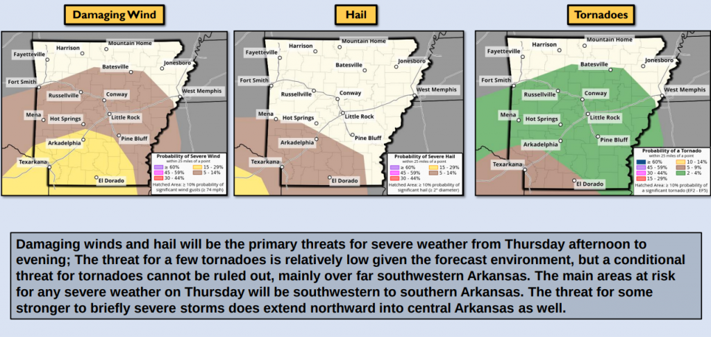
- Areas at Risk: The highest potential for severe weather includes southwestern and southern Arkansas, particularly in the late afternoon to evening hours.
- Hazards: The primary risks include damaging winds and hail. There is also a conditional threat of brief tornadoes, mainly in southwestern Arkansas.
- Storm Development: Isolated storms could develop ahead of the main complex, particularly in the afternoon across southwestern Arkansas. These discrete storms may elevate the tornado risk slightly in the affected areas.
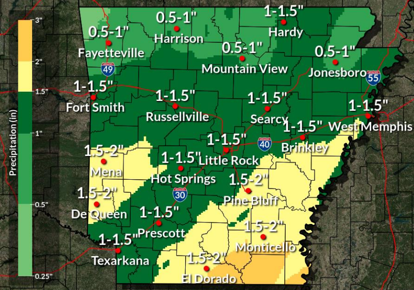
Residents in the impacted areas should monitor weather updates and have a plan in place for severe weather conditions. Heavy rainfall is expected to be widespread, so those in flood-prone areas should exercise caution. Stay tuned to local forecasts for the latest developments.